I didn't have a clear idea of the final design for my maps when I started, so I created a number of mockups to verify usability and readability. Some of the data that I wanted to make sure was included were:
- Index of the difficulty of the section -- spoiler alert: it's a combination of length and elevation changes
- Elevation profile with POI markers
- Section highlights
- Legend/explanation
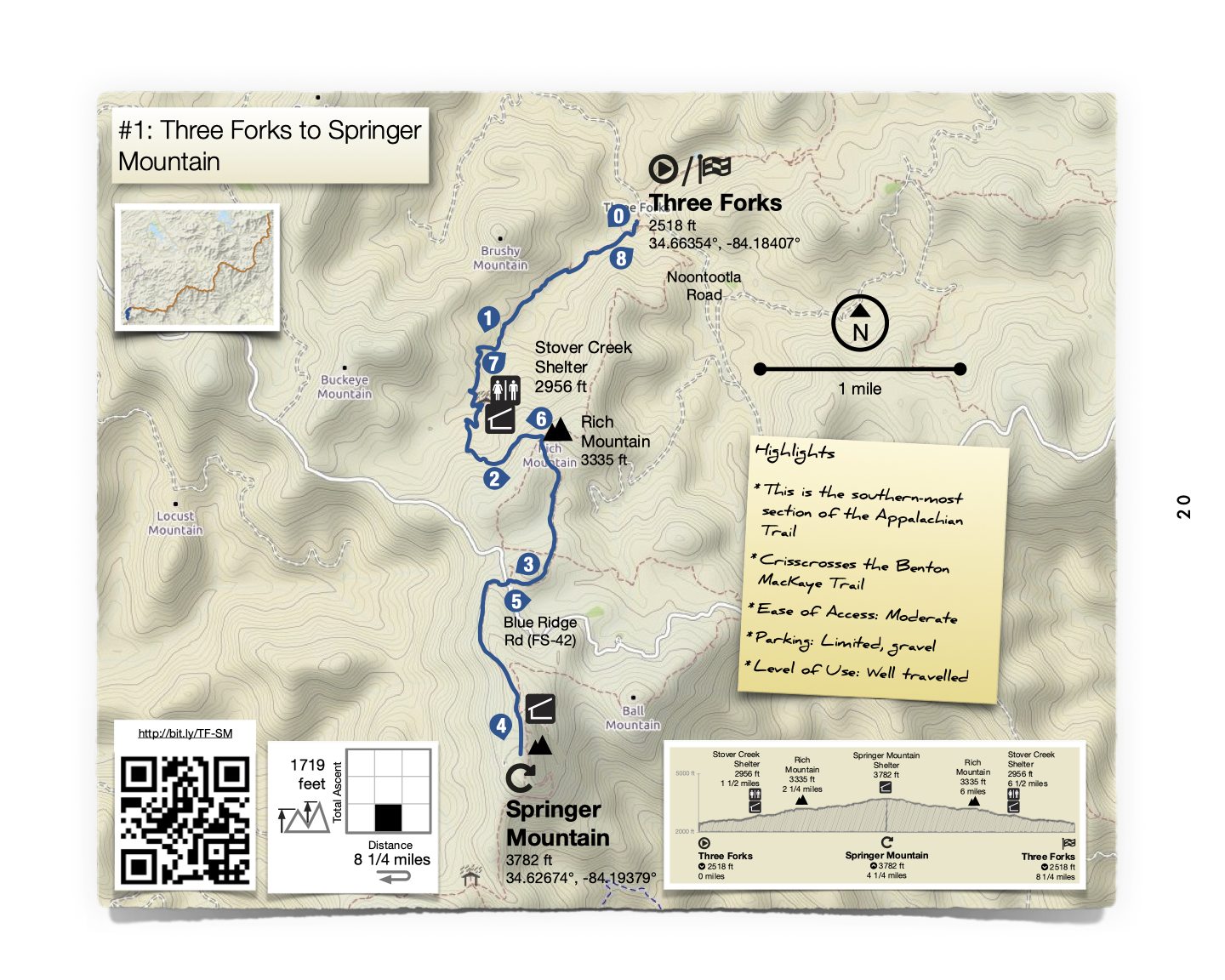
Early iterations:
Sketch

--------------------------------------------
Monochrome
--------------------------------------------
Color
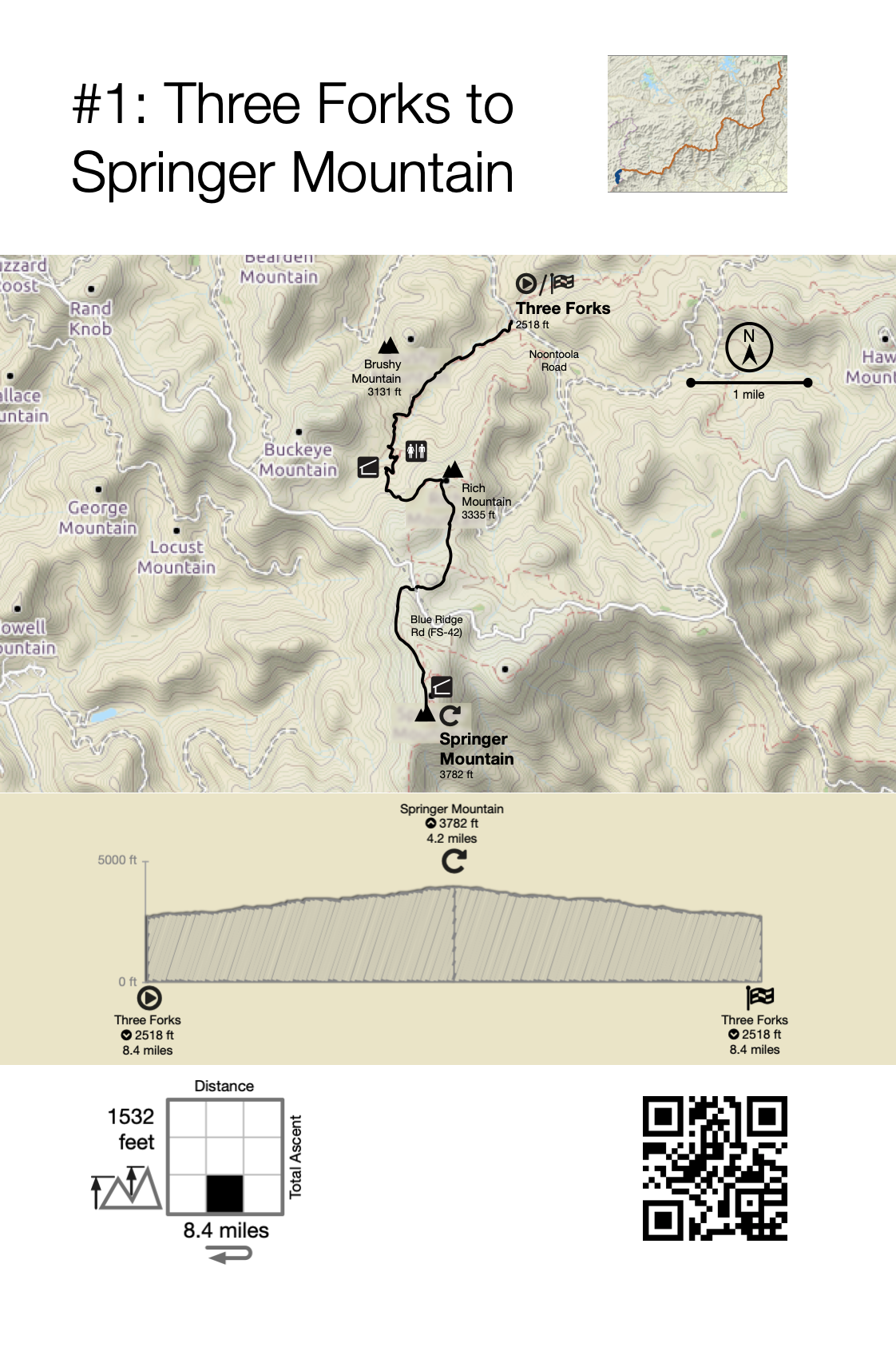
Final design:
More space for map